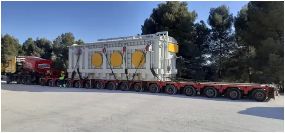
Route feasibility
What an abnormal-load route survey should establish
A route survey turns a line on a map into an executable movement plan, with constraints, evidence, actions and ownership recorded.
Published 2026-09-01Reviewed 2026-09-01
Document review
Mapping, published restrictions, road ownership and loaded-combination data are compared to screen unsuitable corridors.
Not every movement needs the same depth; investigation is proportionate to risk and available clearance.
Geometry and swept path
Roundabouts, junctions and islands are assessed against trailer cut-in, rear swing and the complete loaded envelope.
Critical manoeuvres are recorded with the traffic space and mitigation they require.
Surfaces and structures
Bridges, culverts, yards and temporary roads are reviewed against the expected axle loads and support conditions.
Documentary evidence is supplemented where condition or capacity remains uncertain.
Gradients and manoeuvrability
Slopes and transitions affect traction, braking, ground clearance and trailer articulation.
Recovery space is checked so a manoeuvre does not rely on an unplanned correction.
Traffic and movement windows
Traffic impact, departure restrictions, time windows, roadworks and safe holding areas are identified.
Summer and winter can alter traffic, daylight, weather and surface condition, so temporary constraints need a pre-movement review.
Physical field inspection
Field work checks clearances, signs, vegetation and roadside obstacles that mapping cannot reliably represent.
Every critical observation receives a location, evidence and action owner.
Authority coordination
Survey evidence supports discussions about movement conditions, traffic control and third-party support.
It does not replace the authority decision or the issued permit conditions.
Final access to the unloading point
Gateways, internal turns, gradients, bearing surface, crane position, exclusion areas and vehicle exit are checked together.
The route is executable only when site reception and contingency arrangements connect with the public-road plan.
Final technical checklist
- Loaded combination confirmed
- Critical swept paths reviewed
- Clearances and roadside obstacles checked
- Structures and surfaces screened to risk
- Holding points and contingencies agreed
Frequently asked questions
Can mapping tools replace a field survey?
They support screening, but critical points may need current inspection, measurement and engineering review.
When should a route be revisited?
When relevant conditions change, information is stale, works are present or narrow margins need final confirmation.
Does a route survey guarantee a permit?
No. It supports planning and applications; the competent authority decides the administrative conditions.